top of page

3D MODELING & POINT CLOUD
3D modeled construction projects benefit from better lead times, costing, stability, and safety. Communicating site layout, including the placement of landscape features and utility equipment, can be facilitated through the use of 3D models. The use of 3D modeling has streamlined the construction industry by allowing for faster completion of projects and lowering expenses.
Pilot Lens offers customized 3D modeling solutions for both small and large clients.
Our cost-effective approach utilizes specialized drones to gather data and in-house processing to create accurate 3D models.
These models serve various industries for planning, decision-making, and design purposes, including assessing hazardous areas.
Our services range from 3D topographic maps to infrastructure and asset models, making Pilot Lens the ideal choice for any industry.

Our drones are equipped with high-resolution cameras that capture detailed images of construction sites, which can be processed into precise 3D models.
These models provide an in-depth and accurate representation of the construction site, enabling construction companies to optimize their processes, save time and reduce costs.
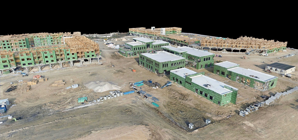
The 3D models created by Pilot Lens can be used for various purposes such as planning, design, and project management, helping construction companies make informed decisions and ensure the success of their projects.
With our innovative solutions, construction companies can benefit from a safer, more efficient and cost-effective construction process.
"3D modeling with our drones revolutionizes the construction industry, providing an accurate and up-to-date representation of the site, enabling companies to make informed decisions."
-Ty Cody, Founder of Pilot Lens.
The use of 3D models created with Pilot Lens' drones provides a comprehensive and detailed understanding of elevation changes on construction sites.
With accurate data on topographical features, construction companies can make informed decisions on how to navigate complex terrain and design structures that are both safe and stable.
The 3D models can be used to identify potential issues before construction begins, allowing companies to address them proactively and minimize the risk of costly mistakes.
The ability to visualize elevation changes in a virtual environment also streamlines communication between project stakeholders, reducing the possibility of misunderstandings and miscommunications.
Ultimately, incorporating 3D modeling with drones into construction processes leads to safer, more efficient and cost-effective construction outcomes.

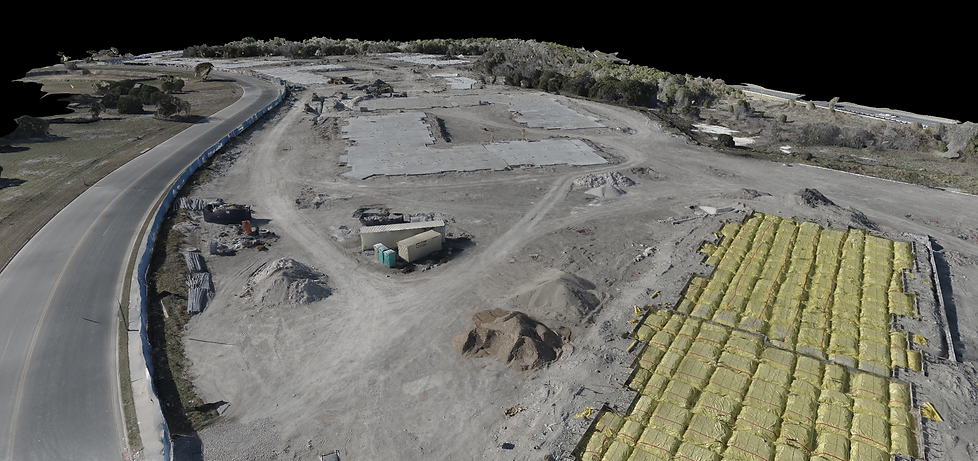
Our drones can be programmed to capture images of construction sites on a regular basis, whether it be weekly, bi-weekly, or monthly.
This allows construction companies to monitor the progress of their projects in real-time and make any necessary adjustments as the work progresses.
The 3D models created from these images provide an up-to-date representation of the site, which is essential for effective project management and ensuring that the project stays on track and within budget.
bottom of page